
Washington · Seattle

Smartphone tolling, validated.

The first U.S. demonstration of a smartphone tolling app on a live state-managed tolled facility — independently evaluated by CDM Smith, presented to Governor Ferguson and the Washington Senate and House Transportation Committees, January 2026.

↓ Read the CDM Smith final report to WSTC (PDF)

Tolling · Seattle · SR 520
WA · DWS 7284 99.97% paired
SR 520 WB · Bellevue → Seattle
8:12 — 8:19 a.m.
Charged · Good To Go!
4.3 mi · 7 min · SOV
$4.95
Detections Map
0%
Accuracy on SR 520 · paired
6 weeks
Contract to live
$0
New roadside infrastructure
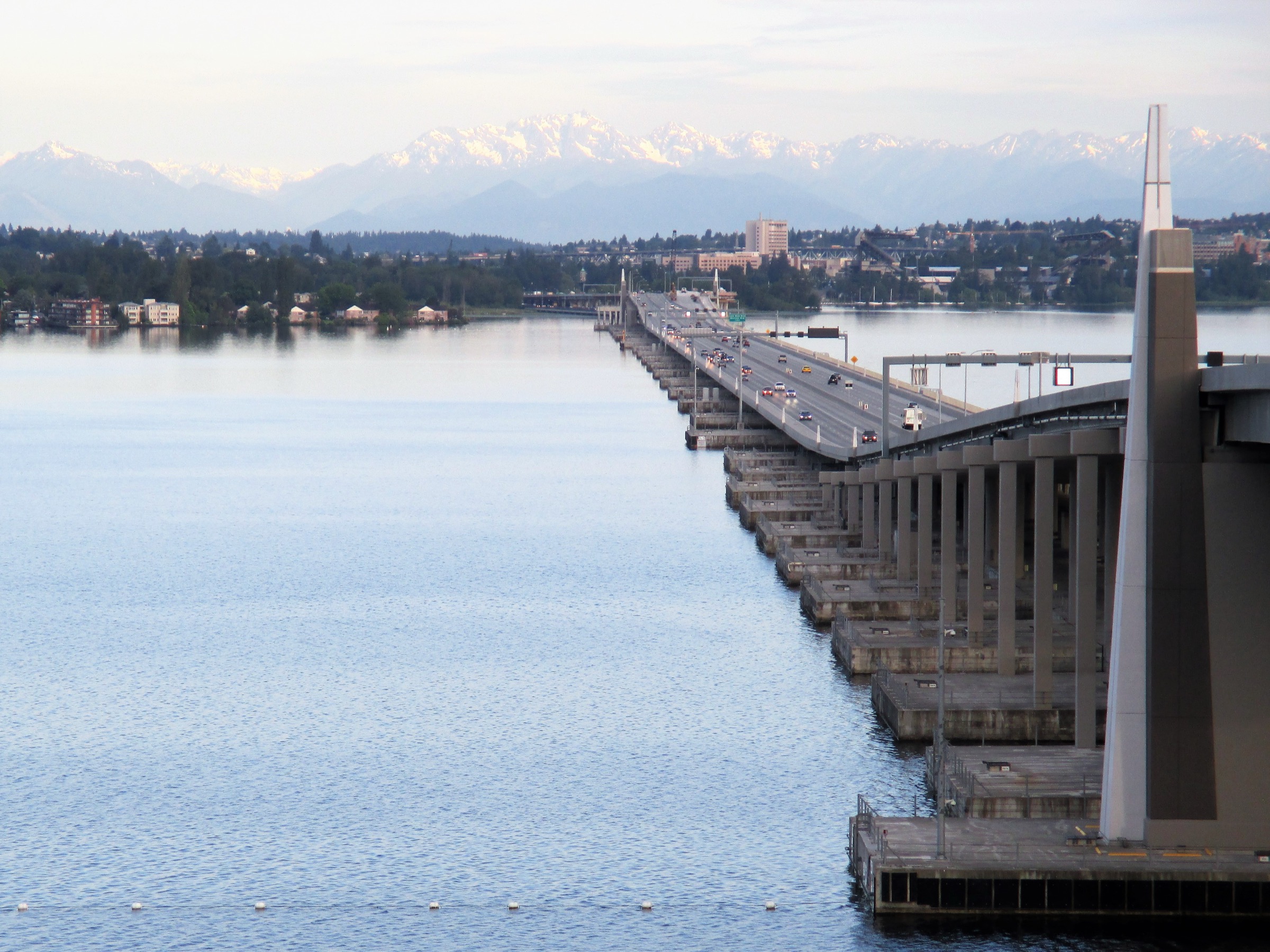
SR 520 floating bridge across Lake Washington with the Olympic Mountains in the background
SR 520 · Evergreen Point floating bridge
The live smartphone-tolling pilot — Lake Washington, looking west toward the Olympics.
We see it as a very viable and complementary way of advancing tolling into the future.

Reema GriffithExecutive Director · Washington State Transportation Commission · IBTTA Tolling Technology Summit · May 2026

In partnership with
The pilot

Six months. From budget to legislative report.

The Washington State Transportation Commission was directed by the 2025/27 Transportation Budget Proviso (Section 205) to "conduct pilot or pilots of advanced tolling technology provided by the private sector" — to assess viability and accuracy of technologies that could reduce implementation costs or enable more flexible operations. WSTC ran a global scan, selected GoCarma, recruited Good To Go! customers, and delivered findings to the legislature on schedule.

Step 1
Global tech scan
Surveyed emerging tolling technology in the U.S. and abroad.
Step 2
Pilot concept design
Two concepts: SR 520 Bridge single-point + SR 18 segment.
Step 3
Recruit + launch
282 Good To Go! account holders on SR 520; project team on SR 18.
Step 4
Evaluate + report
CDM Smith independent evaluation; presented to Governor + legislature, Jan 2026.
The numbers

282 drivers. 12,908 transactions. Two months.

0
Active participants
Good To Go! account holders on SR 520
0
Toll transactions recorded
SR 520 Bridge · mid-Sept to mid-Nov 2025
0%
Accuracy when paired
Bluetooth-paired vehicle pairing on SR 520
0%
User satisfaction
Survey of 282 participants
0%
Issues auto-resolved
358 of 401 issues handled by chatbot — 43 needed staff
0%
Manual-log match on SR 18
In a 7-mile mountainous corridor with limited cell coverage
Accuracy

Pairing is the lever.

The accuracy delta between Bluetooth-paired and unpaired devices is the single most actionable finding of the pilot. With pairing, the app performed at near-perfect accuracy. Without pairing, it dropped to 64% — but the fix is a one-time onboarding step, not new infrastructure.

Paired via Bluetooth
99.97%
Reliably linked to a vehicle. The app wakes inside the geo-fenced toll zone, records the transaction, and goes back to sleep. No driver interaction.
Without pairing
64%
App could mis-attribute trips when the user was a passenger in another vehicle. CDM Smith recommends roadside cameras as the complementary backstop.
Two corridors

One app. Two very different tests.

Single-point tolling on a busy, currently-tolled bridge. Segment tolling on an untolled mountainous corridor with limited cell coverage. The pilot stressed both ends of the deployment spectrum.

SR 520 Bridge
Single-point tolling.
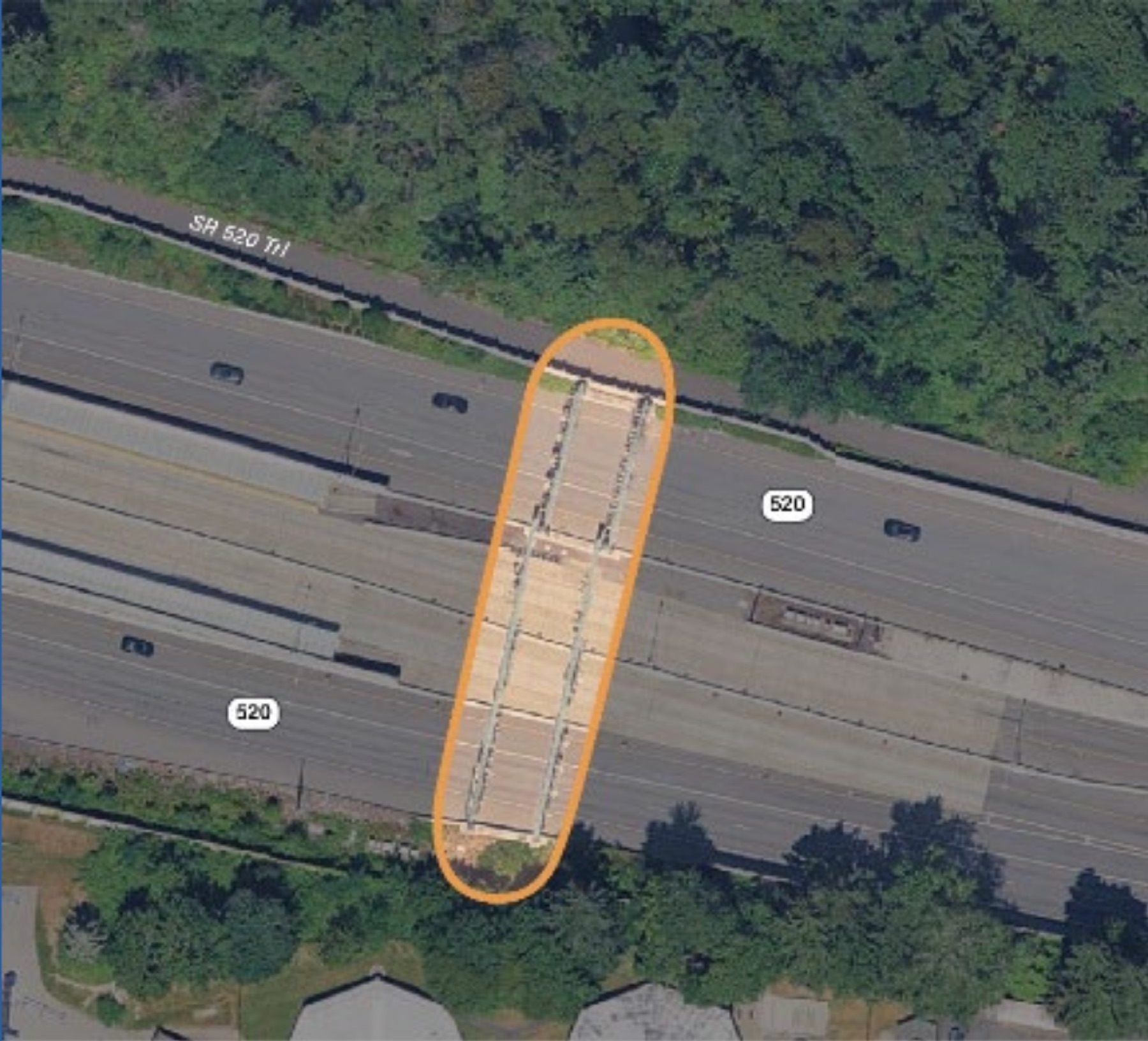
Aerial map of the tolled segment on the SR 520 floating bridge
Tolled segment · SR 520 floating bridge

Tested at the existing gantry on the SR 520 floating bridge across Lake Washington — between Seattle and Bellevue. Compared GoCarma's smartphone tolling against the existing Good To Go! all-electronic toll system, in parallel, on the same drivers.

  • TypeSingle-point, existing
  • PeriodSept – Nov 2025
  • Participants282 public drivers
  • Headline99.97% paired accuracy
SR 18 segment
Segment tolling.
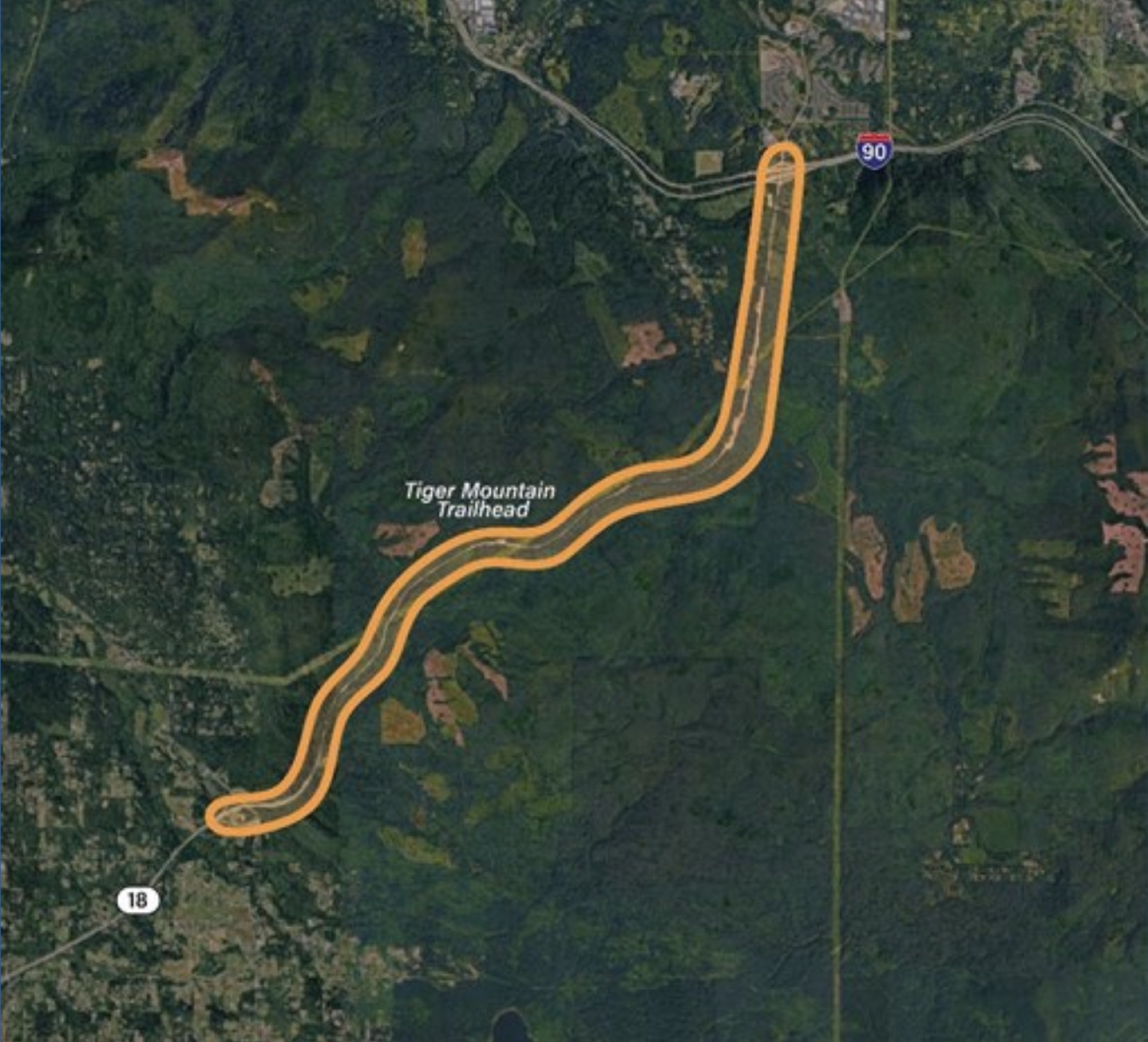
Aerial map of the 7-mile SR 18 corridor between I-90 and SR 18 South — Tiger Mountain area
Test segment · SR 18 between I-90 and SR 18 South

A 7-mile mountainous segment of SR 18 just south of I-90 — currently not tolled, frequent serious accidents, and known to have inconsistent cell signal. Stress-tested smartphone tolling where the conditions are worst.

  • TypeSegment, new (illustrative)
  • Period4 weeks · 2025
  • DriversProject team · scripted routes
  • Headline88% manual-log match · no cameras
How it worked

A virtual gantry. Nothing on the road.

A geo-fenced virtual zone, sized to the corridor, defines where the app pays attention. Outside the zone, location collection is off. Inside, the transaction completes through WSDOT's existing back-office — no gantries, no new readers, no driver interaction.

01
Detect.
Driver enters the geo-fenced toll zone. The app wakes, confirms vehicle pairing over Bluetooth, and records the transaction.
02
Apply.
Toll is calculated from WSDOT's existing rate schedule. Outside the zone, location collection stops.
03
Settle.
Transaction posts to the customer's Good To Go! account through the existing back-office — system-logic update only.
Customer support

358 of 401 issues. No human conversation.

Drivers raised 401 support issues during the pilot — most about app setup and Bluetooth pairing. The in-app chatbot resolved 358 of them without a single staff conversation. Only 43 required employee action. That's the cost-to-collect story in one number.

89%

of customer issues resolved without a phone call

This is the call-center economics that makes smartphone tolling viable at scale. The same chatbot can sit in front of every WSDOT toll customer, paired or not — independent of any decision about a future smartphone-tolling rollout.

What's next

A full operational test.

CDM Smith's recommendation, the WSTC's recommendation, and the legislative direction all align: pilot graduates to a full operational test that combines the smartphone app with roadside vehicle detection to backstop unpaired trips. Phase 2 is under legislator consideration as of 2026.

Phase 2: full operational test

Combine smartphone app with roadside cameras. Carry actual revenue. Test back-office integration end-to-end. Under legislator consideration.

HOV exemption — adjacent capability

CDM Smith also recommended testing occupancy-declaration apps for HOV exemptions on Washington express toll lanes. That capability is already live in Dallas–Fort Worth at scale — 110,000+ users, 136,000 monthly verifications.

An earlier chapter on this corridor

Before the toll, the carpool.

Carma's work on SR 520 didn't start in 2025. It started in 2010 — before tolling existed on the bridge — when WSDOT brought Avego (Carma's predecessor) to Seattle to deploy real-time carpool ride-matching on the corridor as a way to reduce congestion. Microsoft was a partner. A dedicated Windows Phone version of the app shipped alongside the iPhone build to put it in employees' hands at Redmond. Fifteen years later, the same corridor is the proving ground for smartphone tolling.

WSDOT · the client

Washington State Department of Transportation funded a real-time ridesharing deployment on SR 520 to take cars off the corridor. The technology premise was the same as today's — verified shared trips, settled in the app — applied to carpooling rather than tolling.

Microsoft · the partner

Microsoft sponsored a Windows Phone version of the Avego app so its employees could participate from the Redmond campus. The first multi-platform ridesharing client on the corridor came out of that partnership.

Seattle · Case study

Read the full Seattle case study.

The SR 520 smartphone-tolling integration, state-validated 99.97% transaction accuracy, the operating-cost reduction vs. the legacy gantry-based stack, and the integration architecture with WSDOT's back-office.

Could this work for your corridor?